HOTOSM African Highway Segmentation Challenge
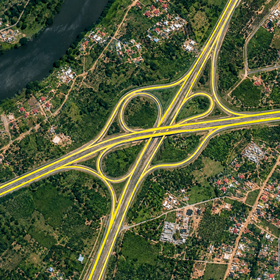
The training set contains 7,246 labelled aerial image tiles from Freetown, Sierra Leone; Nairobi, Kenya; and Stellenbosch, South Africa. Train.csv contains the OpenStreetMap road centrelines and pixel scale for each tile. Some training tiles contain no mapped roads. The test set contains 4,548 tiles.
External datasets
SpaceNet 3 Roads and SROADEX are external sources you can use in line with the challenge rules. If you use external data or pretrained models, disclose their sources.
- SpaceNet 3 Roads: Satellite imagery (0.3m), covering Las Vegas, Paris, Shanghai, Khartoum. Tiles are 1,300 × 1,300px (about 400 × 400m) and include GeoJSON centrelines covering over 8,000 km of mapped roads. Licence: CC BY-SA 4.0.
- SROADEX (Train and Evaluation Code): Aerial orthophotos (0.5m), covering Spain. Tiles are 256 × 256px (about 128m across). The dataset includes 250,442 tiles with binary road masks and 276,715 images without roads. Licence: CC BY 4.0.
Test imagery
Test images are supplied as 256 × 256 pixel, 8-bit RGB PNGs without georeferencing. The ID in Test.csv matches the image filename without the .png extension. The metres_per_pixel column gives the ground distance represented by one pixel. You can use this value to bring images to a common ground scale during preprocessing. Submit your predictions in the original tile’s pixel coordinates.
Files
- HOTOSM_Train.zip Contains the training images, Train.csv, VariableDefinitions.csv, source attribution and the starter notebook.
- HOTOSM_Test.zip Contains the test images, Test.csv with tile IDs and pixel scales, and SampleSubmission.csv with the required submission format.
- HOTOSM_Starter_Notebook.ipynb Included in the training archive. It shows how to load the images, train a baseline model and prepare your first submission.
Extract both archives into the same directory to use the starter notebook with its default data path.
Predictions must be lines in tile pixel coordinates (MULTILINESTRING geometry).
Join the largest network for
data scientists and AI builders