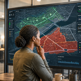
Bias Bounty Mapping Equity Challenge
Participants will work with a combination of open geospatial datasets, authoritative sources, and climate vulnerability indicators.
Coverage gap reference datasets:
- Overture Maps extract (buildings, transportation, POIs)
- Census TIGER/Line Roads
- Microsoft US Building Footprints
- Census ACS housing unit counts
- HIFLD critical facility datasets (hospitals, fire stations, schools, EMS)
- Census County Business Patterns.
Bias API strata datasets:
- CDC Social Vulnerability Index
- U.S. Climate Vulnerability Index
- USDA RUCA Codes (urban/rural)
- TIGER/Line tribal land boundaries; U.S. Drought Monitor
- USFS Wildfire Risk to Communities
- NOAA/CDC HeatRisk
- Supplementary datasets for deeper analysis (heat, wildfire, drought) are listed in the data dictionary
Getting the Data
All challenge data is hosted on Source Cooperative in one public repository: source.coop/humane-intelligence/bias-bounty-mapping-equity-challenge. No credentials or signup are required.
The repository contains three folders:
- reference/ the map data you score: Overture extracts (buildings, roads, rail, infrastructure, POIs) and the reference layers (Microsoft Building Footprints, TIGER/Line Roads, ACS housing, HIFLD facilities, County Business Patterns), clipped to each focus region.
- strata/ tract-keyed demographic, vulnerability, and hazard tables (SVI, CVI, urban/rural, tribal overlap, drought, wildfire, heat). Start with the per-region joined table <region>-strata-tract-table.parquet; national versions of the same tables are also available for context.
- boundaries/ the four study region boundaries as GeoJSON.
Files are cloud-native GeoParquet, so you can query windows of large files directly from the bucket without downloading them. The repository README documents access patterns for GeoPandas, pandas, DuckDB, and the AWS CLI, including how to handle Overture's nested columns. A tutorial notebook walks through loading and exploring each layer; open it directly in Colab at https://colab.research.google.com/github/kentstephen/bias-bounty-map-tutorial/blob/main/bias-bounty-explore-tutorial.ipynb, or via the link in the README. Read the README before you start; it will save you time.
The Overture layers are pinned to release 2026-08-19.0. Compute against this release only; scores computed against other releases will not match the reference.
Sizes, reference/ only: Maricopa about 1.0 GB, Northern California 0.45 GB, Eastern Oklahoma 0.9 GB, and South-Central Texas 3.9 GB, about 6.3 GB for all four. The strata tables add about 1.7 GB. If you want a single download, bulk zips are available in the bucket's bulk-downloads/ folder: reference.zip (all four regions, 6.39 GB) and strata.zip (1.68 GB), each with the README at the top level. If you can install the AWS CLI, aws s3 sync (documented in the README) is still the better route: it resumes if the connection drops, and a failed multi-gigabyte browser download does not.
One warning: the layers are lon/lat (OGC:CRS84). Naming EPSG:4326 makes DuckDB’s spatial extension follow the EPSG authority axis order and read them as lat/lon, so ST_Transform returns POINT (inf inf) and ST_Length_Spheroid returns NaN. The full fix is in the README.
Prohibited target reconstruction
Participants may not use the datasets, source layers, or equivalent copies used in the construction of the challenge ground truth to reproduce, derive, reverse-engineer or approximate the target values. This includes obtaining the relevant TIGER, Microsoft Buildings, HIFLD or CBP data independently from public or third-party sources. Models should predict the target from permitted features rather than reconstructing the reference data against which the target was calculated.
Join the largest network for
data scientists and AI builders