ICLR Workshop Challenge #2: Radiant Earth Computer Vision for Crop Detection from Satellite Imagery
'/%3e%3c/defs%3e%3cpath fill='%23fff' d='M-120-80h240V80h-240z'/%3e%3cpath d='M-120-80h240v48h-240z'/%3e%3cpath fill='%23060' d='M-120 32h240v48h-240z'/%3e%3cg id='b'%3e%3cuse xlink:href='%23a' stroke='%23000'/%3e%3cuse xlink:href='%23a' fill='%23fff'/%3e%3c/g%3e%3cuse xlink:href='%23b' transform='scale(-1 1)'/%3e%3cpath fill='%23b00' d='M-120-24v48h101c3 8 13 24 19 24s16-16 19-24h101v-48H19C16-32 6-48 0-48s-16 16-19 24z'/%3e%3cpath id='c' d='M19 24c3-8 5-16 5-24s-2-16-5-24c-3 8-5 16-5 24s2 16 5 24'/%3e%3cuse xlink:href='%23c' transform='scale(-1 1)'/%3e%3cg fill='%23fff'%3e%3cellipse rx='4' ry='6'/%3e%3cpath id='d' d='M1 5.85s4 8 4 21-4 21-4 21z'/%3e%3cuse xlink:href='%23d' transform='scale(-1)'/%3e%3cuse xlink:href='%23d' transform='scale(-1 1)'/%3e%3cuse xlink:href='%23d' transform='scale(1 -1)'/%3e%3c/g%3e%3c/svg%3e)

'/%3e%3cpath fill='%23c09300' stroke-width='1.074' d='m453.16 315.06 9.613 43.755-3.158 3.155-3.3-2.439-5.451-39.018 2.296 39.018-3.157 4.016-3.157-4.016 2.296-39.018-5.45 39.018-3.303 2.44-3.154-3.156 9.611-43.755h6.314z'/%3e%3cg id='b' fill='none' stroke-linejoin='round' stroke-width='1.27'%3e%3cpath fill='%23fff' stroke-width='1.189' d='m428.48 295.84-19.08 67.705 26.255 4.018 11.188-50.924-18.363-20.8z'/%3e%3cpath d='m422.17 318.94 2.296 5.593 12.405-11.848'/%3e%3cpath d='m430.76 304.92 2.596 24.346 7.89-10.328m-3.156 4.012 4.31 14.875m1.69-5.465-8.718 13.241m2.72 13.216-2.791-13.198-2.436-13.423-5.84 7.91-2.562-9.12-8.174 8.385 4.157 15.25 5.738-9.434 3.155 9.612 5.89-9.162'/%3e%3cpath d='m414.99 361.97 5.3-7.444 3.452 11.457 4.735-8.032 3.157 9.614'/%3e%3c/g%3e%3cuse xlink:href='%23b' transform='matrix(-1 0 0 1 900 0)'/%3e%3cg stroke-linecap='round' stroke-linejoin='round' stroke-width='1.27'%3e%3cpath stroke-width='2.378' d='M450 393.81c19.943 0 39.024-1.578 50.213-4.734 4.735-.859 4.735-3.298 4.735-6.455 4.736-1.578 2.295-7.17 5.595-7.17-3.3.862-4.016-5.595-8.033-4.732 0-5.597-5.596-6.313-10.33-4.738-9.47 3.158-26.255 3.875-42.18 3.875-15.924-.717-32.567-.717-42.18-3.875-4.733-1.575-10.326-.859-10.326 4.738-4.018-.863-4.736 5.594-8.034 4.731 3.299 0 .86 5.593 5.594 7.17 0 3.158 0 5.597 4.878 6.456 11.045 3.156 30.128 4.734 50.068 4.734z'/%3e%3cpath d='M422.89 363.54c6.454.861 13.628 1.578 19.225.861 3.153 0 5.45 5.45-.863 6.313-5.593.715-14.345 0-19.08-.862-4.017-.718-12.768-2.295-18.364-3.876-5.594-2.436-1.576-7.168 1.578-6.452 4.879 1.577 11.192 3.157 17.505 4.016zm54.23 0c-6.457.861-13.628 1.578-19.081.861-3.3 0-5.596 5.45.717 6.313 5.596.715 14.347 0 19.078-.862 4.019-.718 12.77-2.295 18.364-3.876 5.597-2.436 1.58-7.168-1.577-6.452-4.878 1.577-11.19 3.157-17.501 4.016z'/%3e%3cpath d='M403.09 360.39c-4.877-.861-7.172 4.732-5.593 7.887.717-1.578 4.017-1.578 4.735-3.155.858-2.437-.718-2.437.858-4.732zm19.08 14.67c0-3.153 3.155-2.765 3.155-5.921 0-1.577-.86-4.018-2.437-4.018-1.579 0-3.158 1.578-3.158 3.156-.718 3.157 2.44 3.63 2.44 6.783zm22.71-9.08c4.73 0 4.262 6.314 1.966 9.47 0-2.295-4.017-3.156-4.017-4.732 0-2.442 3.626-2.442 2.051-4.738zm52.03-5.59c4.878-.861 7.174 4.732 5.595 7.887-.718-1.578-4.017-1.578-4.734-3.155-.86-2.437.718-2.437-.86-4.732zm-19.08 14.67c0-3.153-3.153-2.765-3.153-5.921 0-1.577.86-4.018 2.438-4.018 1.577 0 3.156 1.578 3.156 3.156.718 3.157-2.44 3.63-2.44 6.783zm-22.71-9.08c-4.732 0-4.263 6.314-1.967 9.47 0-2.295 4.015-3.156 4.015-4.732.001-2.442-3.626-2.442-2.048-4.738z'/%3e%3cpath stroke-width='.891' d='M404.67 361.97c1.58 0 4.018.718 4.735 1.577l-4.74-1.58zm7.88 2.44c.862 0 4.018.716 5.596 1.575l-5.6-1.58zm28.7 3.15c-1.578 0-4.734 0-5.593.715l5.59-.72zm-8.75 0c-.859-.862-4.016-.862-5.593 0h5.59zm62.84-5.59c-1.578 0-3.875.718-4.735 1.577l4.735-1.577zm-7.89 2.44c-.86 0-4.017.716-5.595 1.575l5.6-1.58zm-28.7 3.15c1.58 0 4.735 0 5.595.715l-5.6-.72zm8.75 0c.86-.862 4.018-.862 5.595 0h-5.6z'/%3e%3cg fill='%23c09300' stroke='none'%3e%3cpath d='M403.34 374.58c-.534-.102-.815-.525-.68-1.025.164-.609.651-.957 1.112-.794.294.104.83.645.832.839.003.222-.28.752-.402.754-.053 0-.135.046-.182.102-.1.118-.413.175-.68.124zm54.93 3.92c-.199-.074-.515-.518-.515-.724.002-.387.574-1.018.929-1.021.175-.001.655.248.834.434.325.338.254.893-.154 1.208-.201.155-.8.212-1.094.103zm.36 2.48c-.42-.142-.574-.348-.608-.814-.036-.485.012-.56.525-.84l.365-.2.347.155c.48.214.693.445.71.767.018.348-.24.704-.64.883-.352.158-.373.16-.699.05z'/%3e%3cpath d='M407.75 370.09c-.346-.01-.821.307-1.094.469-.649.152-1.404.55-2.031.125-.617-.191-1.438-.04-1.531.718.158.652 1.071 1.025 1.625.594.41-.537 1.531-.853 1.656.063-.457.692-.405 1.609-.781 2.344-.061.457-.252.892-.5 1.28-.462.047-.954-.007-1.344.282-.626.034-1.265.345-1.625.875-.403.578-.789 1.165-.906 1.875.107.725.937.933 1.562.969.667.183 1.335.424 2 .625 1.086.243 2.102.635 3.188.875 1.584.477 3.248.697 4.844 1.125.167.055.324.104.5.125.662.137 1.007-.583 1.062-1.125.329-1.16.58-2.34.906-3.5.225-.466.497-1.517-.406-1.281-.515.308-.952.773-1.594.812-.874.05-.375.945-.031 1.313.076.587-.11 1.288-.5 1.75-.52.33-1.172-.057-1.719-.188-.574.01-1.723-.283-1.187-1.062.19-.577.207-1.209.437-1.782.294-.614.336-1.285.469-1.937-.361-.777-.979.256-1.469.344-.338.234-1.605.334-.937.937.575.437.134 1.197.03 1.75-.036.77-.837.954-1.468.781-.628-.03-1.501-.497-.969-1.187.121-.575.322-1.14.438-1.719.237-.698.437-1.363.687-2.062a5.78 5.78 0 0 1 .625-1.75c.018-.686.478-1.276.47-1.97-.048-.338-.2-.461-.407-.468zm-3.594 7.25a.353.353 0 0 1 .219.031c.25.106.257.31 0 .531-.112.097-.24.191-.281.188-.468-.04-.606-.11-.625-.281-.017-.151.03-.195.343-.344a1.45 1.45 0 0 1 .344-.125zm-1.036 5.02c-.496-.466-.416-.806.317-1.353.314-.234.505-.208.863.12.553.504.575.823.087 1.255-.24.213-.346.257-.627.26-.293.003-.376-.034-.64-.282zm3.05.92a.86.86 0 0 1-.623-1.088c.129-.434.203-.477.84-.483.716-.007.854.112.861.741.004.355-.023.437-.2.6-.207.193-.605.297-.878.23zm89.11.08c-.227-.189-.273-.274-.275-.515-.003-.41.233-.712.746-.944.682-.308.96-.266 1.216.186.342.601.325.847-.084 1.252-.225.224-.268.237-.785.242-.507.003-.565-.01-.818-.221zm-85.06 1.15c-.364-.097-.552-.37-.557-.807-.004-.334.02-.387.253-.57.152-.118.39-.22.579-.245.267-.037.364-.013.58.138.55.387.667.77.348 1.14-.34.397-.662.488-1.203.344zm21.92.98c-.08-.1-.26-.16-.278-.287.032-.555.059-1.117.236-1.648.096-.523.012-1.07.194-1.579.187-.927.187-1.882.402-2.803.01-.475.055-.95.193-1.406.157-.722.013-1.476.226-2.19-.023-.267.285-.983.556-.559.394.577.912 1.045 1.421 1.516.438.252.036.624-.266.75-.416.163-.517.62-.487 1.022-.058.414-.225.806-.242 1.23-.087.622-.07 1.254-.151 1.876-.182.609-.113 1.26-.173 1.888.008.398-.182.76-.156 1.16-.048.406-.066.894-.407 1.172-.329.166-.804.138-1.068-.142zm29.7-9.8c-.482.365-.914.795-1.344 1.219-.592.449.487.71.625 1.094.157.586.148 1.21.188 1.812.179.552.258 1.138.218 1.719-.051.622-.863.491-1.218.844-.492.207-.688.69-1.063 1.03-.246.484-.312 1.077-.344 1.626.036.448-.302.95 0 1.344.04.055.086.132.125.187.102.145.343.03.5.063.504-.029 1.029.047 1.5-.157 1.21-.209 2.432-.226 3.657-.28.749.023 1.47-.238 2.218-.22.587.13.851-.506.844-.968-.332-.654-.045-1.429-.312-2.094-.235-.673-.143-1.428-.25-2.125-.015-.549-.711-.752-1.063-.344-.341.345-.893.414-1.156.844-.297.602.627.603.781 1.062.176.465.118.98.156 1.47.115.592-.529.625-.937.687-.537.2-1.29.336-1.594-.313-.19-.48-.165-.993-.219-1.5-.013-.892-.227-1.768-.28-2.656-.052-1.097-.242-2.187-.313-3.281-.01-.456-.071-1.198-.72-1.063zm-.625 8.25.313.031.03.375.032.375-.406.125a3.28 3.28 0 0 1-.407.094 2.55 2.55 0 0 1-.187-.125c-.22-.159-.164-.385.125-.688.163-.17.239-.203.5-.187zm-29.965-9.28c-.38.135-.862.693-1.25.688-.88.062-.757.919-.125 1.218.083.26.005.588.031.875.123.79-.375 1.425-.281 2.22-.044.87-.307 1.717-.344 2.593-.247.903-.25 1.832-.406 2.75-.104.823-.7.533-1.219.312-.004-.356-.027-.705-.031-1.062.216-.817-.441-1.056-1.094-1.156-.686.065-1.023-.523-.875-1.125.295-.351 1.036-.254 1.5-.313.981.204.942-1.112.438-1.562-.345-.636-1.199-.91-1.438-1.563.096-.866-.48-1.732-1.187-2.156-1.089-.076-1.91.863-2.313 1.781-.452.131-.904.267-1.344.438-.709.177-1.72 1.407-.75 1.875.545.15 2.2.528 1.47 1.28-.413.708-1.202.72-1.907.532-.724 0-1.53-.352-1.5-1.187-.148-.75-.123-1.558-.469-2.25-.148-.84-1.1-.643-1.156.125-.733.534-.636 1.397-.125 2.03.319.73.003 1.578-.313 2.25-.19.876-1.155.906-1.843 1.188-.338.131-1.629-.078-1.156.657.753.265 1.652.505 2.437.312.823-.102 1.538-.665 1.938-1.375.552-.56 1.502-.267 2.218-.281.773-.002 1.563.542 2.313.187.217-.564 1.222-1.495 1.531-.53-.053.862.71 1.325 1.5 1.218.864-.05.544.61.531 1.125.057.934.66 1.425 1.438 1.812.265.072.545.048.812 0 .748-.235 1.554-.568 1.781-1.406.304-.68.311-1.45.532-2.156.177-1.13.406-2.26.437-3.406.276-1.039.197-2.136.406-3.188.133-.782.231-1.563.313-2.344-.092-.417-.272-.487-.5-.406zm-6.781 4.156c.151.019.235.204.25.531.016.365.206.661.437.72.183.045.167.238-.03.374-.116.08-.322.127-.688.125-.578-.003-.937-.153-1.25-.469l-.188-.187.281-.188c.142-.108.399-.332.563-.5.285-.29.473-.424.625-.406zm66.031-7.876a8.365 8.365 0 0 0-1.656.25c-1.04-.065-1.563 1.027-.563 1.563.602 1.534 1.54-.317 2.5-.188 1.438.28 1.56 1.832 1.781 3 .081 1.157.415 2.282.75 3.375.963 1.07-.72 1.74-1.437.906-.611-.664-1.92-1.48-2.656-.562-.904.382-.94 1.59-1.688 1.937-1.209.368-1.361-1.119-2-1.75-.587-.824-1.71-.896-2.625-1.187-.429-.869-.205-2.346-1.094-2.938-.745.304-2.113 1.702-.968 2.344 1.117.96-.488 1.401-1 2.063-.732.814-.849 1.936-.969 2.968-1.26.696-1.504-.787-1.656-1.718-.098-1.112-1.036-.786-1.688-.375-.952.385-1.428 1.29-2.094 2-.08.647.038 1.356.032 2.03.216.812 1.202.431 1.812.376.979-.41 1.38.627.594 1.219-.532.676-2.22.322-2.063 1.406.544.063 1.111.043 1.657 0 1.09-.298 2.261-1.068 2.375-2.281.143-1.059 1.667-.866 2.5-1.094 1.04-.3 2.294-.377 2.53.937.71.745 2.25 1.584 3.032.563.795-.485 1.176-1.338 1.125-2.25-.162-.785 1.269-.813 1.625-.375.521.858 2.151.605 2.938.125.836-.617 1.017-1.705 2.218-1.719 1.783-.534 3.635-.841 5.375-1.5 1.41-.307-.21-1.198-.562-1.719-1.074-.53-2.008 1.642-3.219.563-.936-.716-.872-2.077-1.219-3.125-.237-1.358-.177-2.923-1.156-4-.672-.715-1.586-.887-2.531-.844zm-6.813 9.469c.126-.003.268.06.5.187.439.242.751.643.75.969 0 .213-.054.227-.375.375-.197.091-.42.189-.5.188-.18-.002-.624-.357-.625-.5 0-.06-.058-.287-.125-.47-.117-.32-.099-.316.063-.53.103-.138.187-.216.313-.22zm6.532.344c.372-.025.593.091.75.375.181.329.058.58-.407.78-.203.089-.407.16-.437.157-.03-.003-.198-.102-.375-.219-.27-.177-.31-.264-.313-.468-.003-.316.35-.597.782-.625zm-8.938.093c.11-.017.209.04.344.156.18.155.237.28.281.594a2.23 2.23 0 0 1 0 .625c-.048.226-.053.216-.562.219-.64.006-.7-.064-.688-.656.008-.377.012-.478.219-.688.16-.162.297-.233.406-.25zm-5.5 1.438a.57.57 0 0 1 .438.437c.065.318.008.462-.25.594-.222.113-.734.15-.875.063a.613.613 0 0 1-.188-.188c-.068-.121-.055-.18.031-.25.06-.05.126-.12.125-.156 0-.037.068-.163.157-.281a.543.543 0 0 1 .562-.22zm9.25 1.187a.651.651 0 0 1 .438.156c.185.163.179.4-.031.563-.136.104-.872.095-1.125 0-.113-.042-.156-.099-.157-.219-.002-.14.038-.227.281-.344.205-.097.416-.155.594-.156zm-17.171 4.819c-.096-.063-.238-.117-.095-.222.173-.302.518-.407.825-.52a3.436 3.436 0 0 0 1.373-1.118c.05-.333.424-.513.422-.861.003-.475.032-.962-.084-1.426-.129-.426-.452-.752-.827-.974-.256-.202-.674-.258-.768-.614-.053-.343.253-.604.36-.91.223-.421.411-.863.651-1.275.26-.288.659-.015.793.263.19.277.357.576.45.897.303.332.571.721.68 1.162.148.31.383.602.369.966 0 .416.235.787.22 1.206.014.56.013 1.145-.191 1.674-.14.294-.421.47-.607.733-.319.295-.67.579-1.08.736-.289.092-.457.426-.819.345-.514.009-1.037.079-1.547-.004.032.054-.156-.092-.125-.058zm-6.85.45c-.243-.25-.295-.355-.298-.6-.003-.248.045-.346.282-.586.439-.443.653-.453 1.41-.07.722.365.967.399 1.032.14.062-.25.478-.48.874-.481a.82.82 0 0 1 .592.203c.251.196.263.227.27.68.004.463-.002.48-.29.736-.278.244-.323.259-.666.224-.437-.043-.7-.244-.77-.588-.052-.25-.14-.31-.206-.14-.021.055-.129.122-.239.15-.204.051-.549.268-.794.5-.093.087-.255.128-.519.131-.355.003-.405-.018-.678-.299zm-19.82-8.9c-.665.007-1.38.566-1.469 1.219.152.752.777 1.49.375 2.281.278 1.013-.761 1.397-1.469.813-.427-.972-.643-2.036-1.28-2.907-.805-.227-1.155 1.057-1.72 1.5.28.755 1.096 1.433 1.188 2.375.195.915-.361 1.93-1.156 2.406-.686.655-1.626.421-2.47.563-1.023.599.753.818 1.22.844 1.047.106 2.135-.032 2.906-.813.769-.367.71-1.697 1.625-1.844 1.588-.07 3.163.244 4.75.282.85.203 2.163-.101 2.75.53.002 1.108.94 1.791 1.844 2.22.498.138 1.024-.48 1.53-.594.966-.308.673-1.502 1.25-1.969 1.651-.09 3.317-.07 4.97-.093.314.007.407-.44.625-.626-.037-.638-.06-1.272-.157-1.906-.318-.806.052-1.844-.53-2.53-.83-.227-1.537.533-2.376.593-.926.412-1.706 1.268-1.75 2.312-.548.897-1.427-.16-1.125-.906-.034-.325.07-.704-.031-1-.507-.608-1.395-.41-2.094-.5-1.018.04-2.012-.18-3.031-.156-.893-.068-1.822.078-2.688-.156-1.031-.03-.89-1.039-1.062-1.75a1.018 1.018 0 0 0-.625-.188zm2 3.688c.343.006.667.051 1 .093.43.071.89-.148 1.313 0 .976.166 1.953.127 2.937.219.26-.004.446.185.625.344.002.683 0 1.379 0 2.062-.03.258.076.598-.156.781a.7.7 0 0 1-.25.125c-.27-.07-.558-.247-.688-.5-.041-.357.018-.704.031-1.062-.007-.093.04-.237 0-.313a1.248 1.248 0 0 0-.718-.25c-.85-.029-1.682-.091-2.531-.125-.707-.044-1.434.06-2.125-.125-.269-.097-.618-.064-.782-.343-.234-.273.104-.597.344-.72a2.28 2.28 0 0 1 1-.187zm11.281.25c.159-.003.21.05.281.343.046.188.1.417.125.5.037.118-.022.156-.187.219-.494.186-.986.168-1.156-.063-.078-.104.012-.434.156-.562.29-.259.61-.437.781-.438z'/%3e%3c/g%3e%3c/g%3e%3cpath stroke-width='1.15' d='M449.98 327.23c32.642-25.106 29.843-61.883 29.843-61.883a12.72 12.72 0 0 1-2.54.258c-6.848 0-23.179-3.917-26.989-8.892-4.081 4.503-20.77 8.892-27.574 8.892-.861 0-1.722-.086-2.54-.258 0 0-2.843 36.776 29.8 61.883z'/%3e%3cpath stroke-width='.916' d='M477.22 268.04a13.55 13.55 0 0 1-.848.026c-6.205 0-20.619-3.183-26.175-7.957-5.82 4.41-20.47 7.957-26.576 7.957a4.7 4.7 0 0 1-.85-.086c-.014 1.39.059 2.832.145 4.144.323 4.9 1.183 9.819 2.488 14.552 4.108 14.895 12.516 27.553 24.572 37.155 12.066-9.61 20.484-22.28 24.6-37.186 1.308-4.732 2.17-9.65 2.496-14.55.086-1.285.157-2.692.148-4.055z'/%3e%3cpath fill='%23c09300' stroke='none' d='M439.38 265.03c-5.872 1.845-12.229 3.031-15.75 3.031a4.7 4.7 0 0 1-.844-.093c-.014 1.39.07 2.845.156 4.156a72.77 72.77 0 0 0 2.47 14.53c2.764 10.026 7.506 19.033 13.968 26.782V265.03zm20.62-.09v49.25c6.794-7.921 11.733-17.206 14.594-27.562a72.952 72.952 0 0 0 2.469-14.531c.085-1.284.166-2.7.156-4.063-.28.018-.56.032-.844.032-3.73 0-10.42-1.17-16.375-3.125z'/%3e%3cg stroke-width='1.27'%3e%3cpath stroke-width='1.218' d='M462.31 253.09c.667.04-.902-3.568-.902-3.568 1.765 1.804 8.43 2.235 8.43 2.235-4-1.766-7.998-15.096-7.528-25.721.432-10.664-1.528-14.86-3.097-16.428-2-2-8.43-3.764-12.664-4-2.392-.117-2 1.804-2 1.804-4.43-1.137-8.86-1.568-10.86-.235-1.883 1.255-2.275 7.528-.902 6.43 3.332-2.666 6.234-.235 8.233 2.666 1.764 2.549 1.647 9.763-.902 18.192-2.666 8.861-9.959 17.722-9.959 17.722 3.96 0 9.528-3.528 9.528-3.528l-1.333 5.528c4.195-2 7.528-5.097 7.528-5.097l3.999 4.195c1.333-1.764 4-4.195 4-4.195s3.332 3.529 8.429 4z'/%3e%3cpath fill='none' d='M446.12 227.57s-2.235 16.428-6.43 21.094m9.96-21.524s-.863 16.623-3.764 21.956m6.894-21.286s0 18.192 1.098 21.289m2.862-20.389s.902 15.291 4.666 20.819'/%3e%3cpath fill='%23c09300' stroke-width='.354' d='M442.08 219.61c-.196-1.45-.549-2.588-1.059-3.333-2-2.901-4.9-5.332-8.233-2.666 0 0 1.137-3.529 3.568-3.646 1.882-.118 6.155 1.411 9.92 7.841 0 0-2.784-.627-3.45-.039-1.256 1.098-.746 1.843-.746 1.843z'/%3e%3cpath fill='%23c09300' stroke-width='.354' d='M432.44 209.26c.274-.902.706-1.725 1.255-2.078 2-1.333 6.43-.902 10.86.235 0 0-.392-1.921 2-1.803 4.234.235 10.664 2 12.663 3.999.47.51 1.02 1.255 1.49 2.391h-.078c-.98-1.372-3.764-1.293-4.431-1.215-1.059.118-1.725.078-3.137.431-.666.157-1.686.353-2.235.784-.43.353-.784 1.647-1.45 1.647-1.059 0-.98-.274-1.255-.588-.353-.431-.549-1.059-.902-1.02-1.097.197-2.862-.666-5.096-2.43-2.235-1.765-3.098-2.196-5.999-2-2.862.235-3.764 1.843-3.764 1.843l.079-.196z'/%3e%3ccircle cx='448.824' cy='210.672' r='1.176' stroke='none'/%3e%3c/g%3e%3c/g%3e%3c/svg%3e)
Hi everyone,
Congratulations to all winners. It was a very interesting problem to work on.
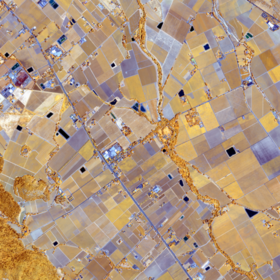
I decided from day one to work with deep learning to see how far it can achieve on such a small, unbalanced and high dimensional dataset without acces to external data or pretraiend models. My idea was to crop a small patch around each field (mostly wider than field size) and patch mask with ones at pixels belong to the field and use both as inputs for a neural network. The first key success to make it work is to apply different augmentations including flipping, rotation, random cropping, mixup and time augmentation.
The model architecture consists of 3-layer Conv-net, Masked Features Averaging layer, 3-layer Bi-directional GRU-net and fully connected classification layer. Masked Features Averaging layer is similar to global average pooling but only averages pixels belong to crop field.
 📷
Figure 1: Model Architecture.
The second key sucess is using Bagging Ensemble by training the model 10 times on different 85% subset of training data.
The data preprocessing steps includes:
- Removing B11
- Adding NDVI, NDWI and a third index using blue and infra-red.
- Applying square root on all bands to reduce skewness
- Applying standard scaling
As a future work, I think the reuslts can be improved dramatically using unsupervised pre-training on the unlabeled data but I didn't have time to try it.
You can find the code here.
At the end, I want to thank the organizers for their tremendous efforts.
Brilliant solution. Congratulations.
Thanks Femi. I appreciate your kind words.
one of the best Solution so far have seen on this platform.
I wil llove you take a webinar on Zindi to take us through, so that we can all learn.
Brilliant one I must confess. Karim??
I agree with you. This platform should be a learning one as well not just about winning prizes. Emphasis should be on the thought process of the solution and less on accuracy.
Thanks a lot guys, I will be happy make a webinar.
Actually, I was contacted by Zindi to make one with AI Ghana community. Would that be suitable to you also?
nice one after your presentation on ICLR we all ready @zindi will take care
learning, Prizes and accuracy are important. to be fair
Congrats KarimAmer on a well-deserved position. I also commend zindi for choosing your solution as the first position, because it follows the theme (Computer vision - use of images as input data) of the problem, in my opinion.
Great job... keep up the good work
Thanks a lot.
congratulations Karim
I have a few questions...
1. whether it's possible to use the same model to classify the crops for different locational satellite images and across different seasons?
2. what kind of errors we can expect when we use the same model to classify different season images?
Thanks.
I think it will not generalize to different locations or seasons with the available training data collected only from one location and across one season.
Congratulations Karim! We are excited to host you this Saturday at AI Ghana Weekend Webinar
Thanks John. I appreciate giving me the chance to talk to the community.
John please lets get intouch. info@wondlifeit.com is my email address
Nice solution