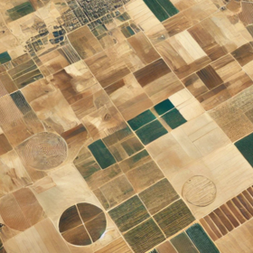
GEOAI Challenge for Cropland Mapping in Dry Environments by ITU
Helping Uzbekistan, Russian Federation
1 000 CHF
Completed (12 months ago)
Classification
Earth Observation
625 joined
184 active
Start
02 Jul 25
Close
29 Sep 25
Reveal
29 Sep 25
First Place ( also unofficial )
Platform · 2 Oct 2025, 11:59 · 7
Data Aspects
- I use Sentinel 2 data of train coordinates both locations ( Fergana , Orengurg ).
- also Cloud Probability from sentinel 2 used.
- Timeseries span about 4 years.
- GEE used collection with CLOUD_COVER_PERCENT 20 ( similar as test data ).
Feature Engineering
Sentinel 2 bands used B2 to B12 ( simiar as test data ).
Added Normalized Difference indexes such as ( ex: BNDVI, MNDVI, NDVI, NDVI705, RENDVI, RNDVI, GNDVI, WI2, WI1, VrNIRBI, VIG, VI700, etc..).
Also Transform 4 year timeseries to aggregated of each month.
that data structure like ( sample_size, months, features )
Model Architecture
Since data structure is 2D, it best to use conv layer, so an Simple stack of convolution with dropout layer
Insight
- Very few samples in train coordinate mislabel note by [@ZaakciiRu](https://zindi.africa/competitions/geoai-challenge-for-cropland-mapping-in-dry-environments/discussions/28437) but I didn't manualy remove any sample. so to counterbalance loss function with label_smoothing 0.1 value.
- very heavy dropouts used during training.
Hi,
Thanks for sharing and it's amazing that one could achieve such a high score using only Sentinel 2 data.
If you don't mind, I'd like to ask what you meant by this:
"....so to counterbalance loss function with label_smoothing 0.1 value."
How did you implement it?
I using Tensorflow for model construction, so some of loss functions is predefined,
ex:
https://www.tensorflow.org/api_docs/python/tf/keras/losses/BinaryCrossentropy
also label smoothing is one of the technique to help model generalization.
Oh ok, got it. Thanks
Hello, amazing work winning this competition. By chance do you have a github repo for this competition?
I don't know it okay with host
it is okay. I mean we are always encourgaed to share our solutions with the community!
If possible kindly let us know.