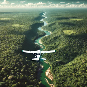
GeoAI Amazon Basin Secret Runway Detection Challenge by ITU
and 1 other country
- Austria
- Peru
- Italy
- Scroll to see more

'%3e%3cpath fill='%23001489' d='M0 0v6h9V0z'/%3e%3cpath fill='%23e03c31' d='M0 0v3h9V0z'/%3e%3cg stroke='%23fff' stroke-width='2'%3e%3cpath id='d' d='m0 0 4.5 3L0 6m4.5-3H9'/%3e%3cuse xlink:href='%23b' stroke='%23ffb81c' clip-path='url(%23c)'/%3e%3c/g%3e%3cuse xlink:href='%23d' fill='none' stroke='%23007749' stroke-width='1.2'/%3e%3c/g%3e%3c/svg%3e)
Hello Participants!
We hope you’re ready and excited to tackle the GeoAI Amazon Basin Secret Runway Detection Challenge with ITU and Zindi.
For this challenge the error metric is Accuracy. However, the scoring will work slightly differently to our normal challenges.
For every predicted runway you will create a buffer region of 20 pixels around the runway. This buffer should extend 20 pixels in all directions ((left, right, top, and bottom). By adding this buffer you will submit a reduced submission file of max 200 000 rows. !NB Note the sample submission file shared is >25m rows - you will not submit this but rather your reduced submission file.
The reference file of ground truth labels against which you will be scored has also been reduced to ~ 200 000 rows. In the scoring process your file will be merged with the reference file. You will be scored on matching IDs. When the competition closes selected submissions from the top 10 participating users/teams will be scored fully.
Happy coding!
Great !!!
Should the reduced submission file include only the rows with detected pixels (label being equal to 1)?
Your submission file should contain 2 columns:
tile_row_column, label
tile_row_column has tile name and label would be 0 or 1 (1 for detected runways)
Your rows will be determined by your detected runways and your buffer region around those. You should be submitting ~200k rows.
Re:
"For every predicted runway you will create a buffer region of 20 pixels around the runway. This buffer should extend 20 pixels in all directions ((left, right, top, and bottom). By adding this buffer you will submit a reduced submission file of max 200 000 rows. !NB Note the sample submission file shared is >25m rows - you will not submit this but rather your reduced submission file."
Could you elaborate a bit on what you mean by adding a buffer and how this leads to a reduced submission file?
Totally agree that wasn't clear. e.g. what if there's a tile posititive on the edge. does the buffer only extend inward? need to get more info on this "buffer"...
Regarding the buffer region, as I understand it, you've incorporated this on the ground truth data that you will use to judge entries. Meaning that you draw a line on the runway and then all the indexes that are within the buffer should have value 1. I've assumed that the indexes in the submission file correspond to pixels.
I've also added a buffer when preparing my training data, but I've found there are many ways to do it. One can make a circle with radius 20 on every pixel on the runway and mark all that with one. One can also make a cross on every pixel, marking the 20 pixels on every side of every pixel with 1. This is taking @meganomaley 's instructions more literally.
This may seem like a nitpick, but by plotting these alternatives, I've seen that it changes a lot about how the buffer area ends up looking. (more specifically, it might change by a factor sqrt(2))
If one of the organizers (eg, @Lolletti @meganomaley) could have a look, I'd really appreciate it!
Sorry, I misspelled you, @meganomaly
Here is a picture of a cross-shaped buffer, so it's clearer what I mean: https://imgur.com/a/iFxtTlM