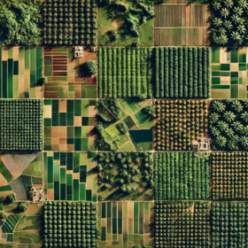
Côte d’Ivoire Byte-Sized Agriculture Challenge

Helping Côte d'Ivoire
7 000 EUR
Completed (over 1 year ago)
Classification
Object Detection
901 joined
163 active
Start
25 Apr 25
Close
16 Jun 25
Reveal
16 Jun 25

'/%3e%3c/defs%3e%3cpath fill='%23fff' d='M-120-80h240V80h-240z'/%3e%3cpath d='M-120-80h240v48h-240z'/%3e%3cpath fill='%23060' d='M-120 32h240v48h-240z'/%3e%3cg id='b'%3e%3cuse xlink:href='%23a' stroke='%23000'/%3e%3cuse xlink:href='%23a' fill='%23fff'/%3e%3c/g%3e%3cuse xlink:href='%23b' transform='scale(-1 1)'/%3e%3cpath fill='%23b00' d='M-120-24v48h101c3 8 13 24 19 24s16-16 19-24h101v-48H19C16-32 6-48 0-48s-16 16-19 24z'/%3e%3cpath id='c' d='M19 24c3-8 5-16 5-24s-2-16-5-24c-3 8-5 16-5 24s2 16 5 24'/%3e%3cuse xlink:href='%23c' transform='scale(-1 1)'/%3e%3cg fill='%23fff'%3e%3cellipse rx='4' ry='6'/%3e%3cpath id='d' d='M1 5.85s4 8 4 21-4 21-4 21z'/%3e%3cuse xlink:href='%23d' transform='scale(-1)'/%3e%3cuse xlink:href='%23d' transform='scale(-1 1)'/%3e%3cuse xlink:href='%23d' transform='scale(1 -1)'/%3e%3c/g%3e%3c/svg%3e)
Test & Train geojson data provision
14 May 2025, 10:48 · 0
From the new rules, instructions are clear that we are not supposed to use geometry to derive new features, we are to maximize the use of bands provided. However, some participants might need to download the elevation data for various location IDs which follows the copernicus data formart. The IDs have changed and as such, we cannot use the old data. Using only the features derived from the bands won't be sufficient enough to build a robust model IMO.
Discussion 0 answers